

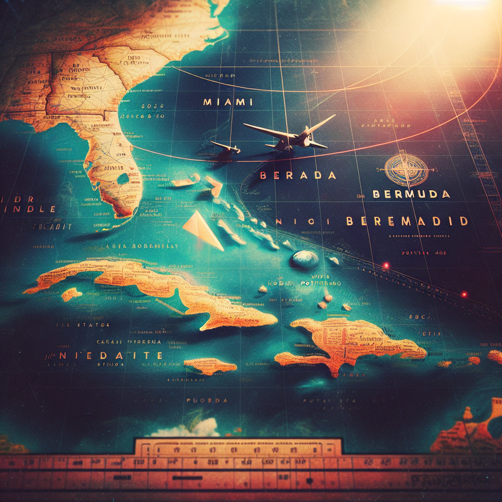
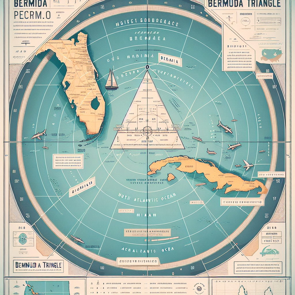
The Bermuda Triangle Map, renowned as the Devil’s Triangle, exerts a timeless allure on skeptics and believers alike, fueling their fascination with the supernatural. Spanning from Miami to Bermuda and Puerto Rico, this mysterious expanse has sparked countless theories and speculations about its purported involvement in the baffling vanishings of ships and aircraft.
Historical Context
Dating back to the early 20th century, the Bermuda Triangle Map started attracting attention with reports of unexplained phenomena. One of its most famous incidents occurred in 1945 when Flight 19, a squadron of U.S. Navy bombers, vanished during a training exercise. Since then, this region has claimed countless ships and planes, igniting ongoing speculation and intrigue.
Political Structure
Bermuda functions as a self-governing British overseas territory with a parliamentary government. According to the 1968 constitution, the British monarch, represented by the governor, holds the position of head of state. The premier, leading the majority party in the legislature, manages the executive branch, while the bicameral legislature guarantees democratic representation for all citizens.
Magnetic Anomalies
One compelling theory suggests that magnetic anomalies within the Bermuda Triangle play a significant role. The region’s reputation for magnetic irregularities is well-documented, with compass needles often behaving strangely. Researchers speculate that these anomalies may disrupt navigation equipment, causing confusion and potentially contributing to accidents.
Misinterpretation
In numerous instances, investigations into Bermuda Triangle incidents have uncovered cases of human error or misjudgment. Navigation errors, mechanical malfunctions, and insufficient training have all been identified as factors contributing to maritime and aviation accidents in the region. While the mystery continues to entice, rational explanations typically emerge upon closer examination.
Scientific Scrutiny
Despite persistent myths, scientific inquiry consistently debunks sensational claims about the Bermuda Triangle. Through rigorous investigation, researchers have illuminated the true nature of incidents, dispelling notions of supernatural phenomena.

Criticism of the Bermuda Triangle Concept
Larry Kusche’s Findings
In his book “The Bermuda Triangle Mystery: Solved” (1975), Larry Kusche delivered a comprehensive critique of the Bermuda Triangle mystery. He meticulously exposed numerous inaccuracies and inconsistencies found in the accounts of writers such as Berlitz. Kusche’s research revealed crucial insights, including:
- Discrepancies in Reported Incidents: Kusche exposed instances where crucial details were omitted or distorted, like the location of incidents and the weather conditions at the time.
- Proportional Disappearance Rates: He contended that the number of ships and aircraft reported missing in the Bermuda Triangle was not significantly higher than in other ocean regions.
- Inflated Numbers and Misreported Events: Kusche discovered that some disappearances were exaggerated or fabricated, adding to the mystique surrounding the Bermuda Triangle.
- Manufactured Mystery: Ultimately, Kusche concluded that writers perpetuated the legend of the Bermuda Triangle by capitalizing on misconceptions and sensationalism.
Further Responses
Lloyd’s of London Investigation
- When the British Channel 4 program “The Bermuda Triangle” (1992) aired, Lloyd’s of London conducted an investigation to determine if an unusually high number of ships had sunk in the Bermuda Triangle area. They uncovered no evidence to support this assertion and concluded that the number of disappearances was relatively insignificant compared to overall maritime traffic.
United States Coast Guard’s Stance
- Expressing skepticism about the Bermuda Triangle, the United States Coast Guard has contradicted many incidents reported by Triangle authors with its records and investigations.
Scientific Evaluation
- The Nova/Horizon episode “The Case of the Bermuda Triangle” (1976) dismissed the mystery as unsubstantiated, asserting that ships and planes in the Triangle behaved similarly to those in other parts of the world.
Skeptical Researchers’ Perspectives
- Ernest Taves and Barry Singer, skeptical researchers, have criticized the bias in media coverage, arguing that sensationalized mysteries like the Bermuda Triangle often overshadow well-researched, skeptical viewpoints.
World Wide Fund for Nature Study
- In 2013, a study conducted by the World Wide Fund for Nature identified the world’s most dangerous waters for shipping, with the Bermuda Triangle notably absent from the list. This finding further challenges the notion of its exceptional danger.
Benjamin Radford’s Insight
- Author and investigator Benjamin Radford emphasized the challenge of locating lost aircraft at sea due to vast search areas. He cautioned against attributing disappearances to paranormal phenomena without sufficient evidence.

Hypothetical Explanation Attempts
Paranormal Explanations
Some proponents of the Bermuda Triangle mystery have suggested supernatural causes for the incidents.
- Atlantis Technology: One theory linking the Bermuda Triangle phenomena to the mythical lost continent of Atlantis attributes disappearances to leftover Atlantean technology.
- Parallel Universe: Another hypothesis suggests the existence of a parallel universe in the Triangle region, creating a time/space warp that engulfs objects into another dimension.
- UFOs:Some have cited UFO sightings as a potential explanation for some Triangle incidents, suggesting extraterrestrial involvement in the disappearances.
Natural Phenomena
Various natural phenomena have been put forward to rationalize Bermuda Triangle incidents:
- Compass Variations: While Triangle incidents often mention compass problems, natural magnetic variations and navigational errors offer more plausible explanations.
- Gulf Stream: The powerful Gulf Stream current flowing through the region can carry away objects, leading to discrepancies between reported and actual positions.
- Human Error: Many official inquiries into Triangle incidents highlight human error as a significant contributing factor, such as navigating into storms or overloading vessels beyond their capacity.
- Violent Weather: Hurricanes, downdrafts, and other extreme weather events common in the area have historically caused maritime disasters, including those in the Bermuda Triangle.
- Methane Hydrates: Some suggest that methane eruptions from underwater hydrate deposits could disrupt buoyancy, causing ships to sink rapidly without warning.
Notable Incidents
HMS Atalanta
The disappearance of the sail training ship HMS Atalanta in 1880, presumed to have sunk in a powerful storm, captured worldwide attention.
USS Cyclops
The disappearance of the USS Cyclops in 1918 stands as the largest loss of life in US Navy history not related to combat, with theories ranging from storms to structural failure.
Flight 19
The mysterious disappearance of Flight 19, a training flight of five TBM Avenger bombers, in 1945, along with the subsequent vanishing of a search aircraft, continues to stand as one of the most famous Bermuda Triangle incidents.
Star Tiger and Star Ariel
The disappearances of two Avro Tudor IV passenger aircraft, Star Tiger in 1948 and Star Ariel in 1949, while operating near the limits of their range, continue to puzzle investigators.
Douglas DC-3
The inexplicable disappearance of a Douglas DC-3 aircraft in 1948, en route from San Juan to Miami, remains unsolved, with no wreckage or bodies ever found.
Connemara IV
The case of the pleasure yacht Connemara IV, discovered adrift in the Atlantic in 1955, emphasizes the dangers of hurricanes and the unpredictability of maritime conditions in the Bermuda Triangle.
Bermuda: A Closer Look
The Archipelago
Bermuda, a stunning self-governing British overseas territory, boasts 7 main islands and around 170 additional islets and rocks. Nestled approximately 650 miles east of Cape Hatteras, North Carolina, Bermuda showcases nature’s splendor in the heart of the vast Atlantic Ocean.
Landscape
Bermuda, with its fishhook-shaped cluster of islands, stretches about 24 miles in length and less than a mile in width on average, connected by charming bridges. The largest among them, Main Island, spans 14 miles in length and 1 mile in width. Majestically rising to 259 feet, The Peak, the island’s highest point, offers panoramic views of the surrounding beauty. Serving as the vibrant heart of Bermuda, the capital, Hamilton, pulsates with culture and history.
Culture and Society
Diversity and Heritage
Bermuda’s population weaves a vibrant tapestry of cultural diversity. Around three-fifths of its populace trace their ancestry to Africa, the West Indies, or Cape Verde. Another one-third comprises descendants of European settlers, embracing British and American heritage. Since the 19th century, Portuguese immigrants from Madeira and the Azores have contributed their unique legacy to Bermuda’s cultural mosaic.
Language and Religion
English serves as Bermuda’s official language, interweaving with traces of Portuguese in everyday discourse. Christianity dominates, with Anglicanism playing a significant role in the religious landscape. Bermuda’s diverse heritage enriches its cultural fabric through a vibrant tapestry of traditions and customs.
Economy and Tourism
Economic Landscape
Bermuda’s flourishing market economy thrives on tourism and international finance, propelling it forward. With one of the highest Gross National Product (GNP) per capita rates worldwide, Bermuda shines as a symbol of economic prosperity and opportunity. Agriculture takes a back seat, as the island’s economy leans heavily on imports for sustenance.
Tourism and Attractions
Annually attracting over half a million tourists, Bermuda captivates with its pristine beaches, historic landmarks, and natural marvels. Visitors are drawn to the breathtaking beauty of pink sand beaches like those found at Tobacco Bay and Horseshoe Bay. The historic town of St. George, designated as a UNESCO World Heritage site, provides insight into Bermuda’s colonial history, while the mystical depths of the Crystal Caves call out to adventurers, inviting exploration.
Physiography
Defining the Boundaries
Multiple boundaries have defined the extents of the Atlantic Ocean, creating a complex scenario, especially in the north. Further complicating matters, the Arctic Ocean is often viewed as a dependent sea of the Atlantic. However, this article treats the Arctic Ocean as a distinct entity.
Northern Boundaries
Efforts to define the open-water boundary between the Atlantic and Arctic oceans frequently resort to arbitrary latitude coordinates or linear transects. A less arbitrary approach entails tracing the division between the distinct water masses of the Arctic and Atlantic.
Southern Boundaries
The southern boundaries of the Atlantic Ocean present a clearer delineation, as the waters surrounding Antarctica south of 60° S latitude are designated the “Southern Ocean.” The widely embraced demarcation between the South Atlantic and Indian oceans follows a line that extends southward from Cape Agulhas to the 60° S parallel.
Relief of the Ocean Floor
Mid-Atlantic Ridge
The Mid-Atlantic Ridge stands out as the Atlantic floor’s most remarkable feature, stretching across the entire length of the ocean. This immense median mountain range occupies the central third of the ocean bed and spans approximately 1,000 miles (1,600 km) in width.
Elements of the Continental Margin
Approaching the continents, one encounters an abyssal plain initially, followed by the smooth, undulating surface of the continental rise. Beneath these slopes lie some of Earth’s largest potential reserves of petroleum, natural gas, and coal.
Islands of the Atlantic Ocean
Within the Atlantic Ocean, a myriad of islands, ranging from purely oceanic to partly continental, are scattered throughout, among them Iceland, the Azores, Ascension, and numerous others. These islands enrich the diverse physiography of the Atlantic.
Geology
Origin and Development
Theories of continental drift and plate tectonics explain the origin and development of the Atlantic Ocean. Approximately 180 million years ago, the breakup of the vast protocontinent, Pangea, occurred, leading to the separation of landmasses and the formation of the Atlantic Ocean basin.
Mid-Atlantic Ridge
The Mid-Atlantic Ridge, stretching across the ocean floor, comprises a long rift zone adorned with mountains, volcanoes, and faulted plateaus. It offers conclusive evidence supporting theories of continental drift and plate tectonics.
Bottom Deposits
Calcareous ooze blankets the majority of the Atlantic Ocean floor, exhibiting varying sediment compositions at different depths. Core samples extracted from marine sediment have yielded valuable insights into the geological history of the Atlantic basin.
Climate of the Atlantic Ocean
The North Atlantic
Large-scale wind currents and air masses from North America predominantly influence the weather patterns across the North Atlantic, resulting in variable conditions and the development of extratropical cyclones.
The South Atlantic
In the South Atlantic, prevailing westerlies stretch from around latitude 40° S southward into the Southern Ocean, influencing calm weather in high-pressure zones and turbulent conditions in the higher latitudes of the westerlies.
Hydrology of the Atlantic Ocean
Surface Currents
Surface currents in the Atlantic Ocean are primarily shaped by prevailing winds, although they are also influenced by land boundaries and various factors like evaporation, precipitation, cooling, heating, friction, and the rotation of the Earth. Major warm and cold currents play pivotal roles in the circulation patterns of both the North and South Atlantic.
Deepwater Currents
Deepwater currents are pivotal in orchestrating the circulation of the Atlantic Ocean, exerting significant influence over its temperature, salinity, and biological productivity. This section delves into the mechanisms and distinctive features of deepwater currents in both the North Atlantic and Antarctic regions.
North Atlantic Deep Water
The North Atlantic deep and bottom water spring forth from surface waters plunging between Iceland and Greenland, as well as in the Labrador Sea. This distinct water, marked by intermediate salinity maximums, fans out southward, leaving its imprint on oceanic circulation and the conveyance of nutrients.
Antarctic Bottom Water
In the Antarctic region, frigid bottom water, characterized by its low temperatures and high salinity, is created through the sinking of water from the continental shelf. This dense water then flows northward, leaving its mark on the circulation patterns and biological productivity of the Atlantic Ocean.
Interaction and Mixing
Deepwater currents originating from both the North Atlantic and Antarctic regions engage in a dynamic interplay, mingling with each other and with various water masses. This intricate interaction plays a vital role in redistributing nutrients and shaping the biological productivity of the Atlantic waters.
Oxygen Content
The deep and bottom waters of the Atlantic Ocean stand out for their rich oxygen content, a consequence of swift circulation processes. This abundance of oxygen is pivotal in nurturing marine life across the vast expanse of the Atlantic.

Tides of the Atlantic Ocean
Historical Perspective
Tidal movements within the Atlantic Ocean have been documented since ancient times, with early records dating back to medieval monks in England. Technological advancements have since enhanced our comprehension and forecasting of tidal phenomena.
Characteristics of Atlantic Tides
The ebb and flow of the Atlantic tide are shaped by a myriad of factors, from the contours of coastlines to the intricate topography of the seafloor, as well as the whims of wind and current patterns. Predominantly, semidiurnal tides hold sway, albeit with intriguing variations observed along diverse coastlines and regions.
Notable Tidal Ranges
In select corners of the Atlantic, like Canada’s Bay of Fundy and France’s Brittany coast, awe-inspiring tidal ranges steal the spotlight, soaring beyond 40 feet in places. Throughout the basin, tidal symphonies play out in diverse rhythms, choreographed by the intricate dance of local geography and oceanographic nuances.
Salinity and Temperature
Salinity Distribution
In the Atlantic Ocean, a mosaic of salinity distribution unfolds, shaped by the intricate interplay of evaporation, precipitation, and ocean currents. These fluctuations in salinity cast their ripple effects across marine ecosystems and orchestrate the intricate dance of ocean circulation patterns.
Temperature Gradient
The distribution of sea-surface temperatures in the Atlantic intricately intertwines with ocean currents and climatological phenomena. These temperature fluctuations not only influence marine life but also play a pivotal role in shaping the kaleidoscope of ecosystems spanning various latitudes.
Climate Change Impacts
Observations point to warming trends in the Atlantic Ocean, aligning with broader global climate change patterns. Human activities have played a substantial role in driving these temperature anomalies and reshaping the dynamics of oceanic heat transport.
Economic Aspects
Biological Resources
The Atlantic Ocean teems with a kaleidoscope of marine life, fostering thriving fisheries and bustling economic ventures. Along its coasts, upwelling zones pulse with life, nourishing nutrient-rich areas that give rise to vibrant plankton blooms, serving as the cornerstone of the Atlantic’s bountiful ecosystems.
Fisheries Management
Challenges loom over sustainable fisheries management in the Atlantic, as overfishing and dwindling fish stocks remain pressing concerns. Despite ongoing conservation endeavors, numerous species teeter on the brink of collapse, underscoring the urgent need for effective management strategies.
Environmental Impact
Human activities, from fishing to pollution, exert significant impacts on Atlantic marine ecosystems. Implementing sustainable resource management practices is imperative to counteract environmental degradation and safeguard biodiversity for future generations.
Coastal Aquaculture: A Growing Industry
Coastal aquaculture stands as a cornerstone of marine food production, boasting a storied history dating back to the Middle Ages. Let’s delve deeper into its evolution and profound significance.
Shellfish Culturing
- Origins: The cultivation of shellfish like oysters, mussels, and clams traces back to the Atlantic coast of Europe during the Middle Ages.
- Methodology: Production primarily occurs in protected embayments and estuaries, fostering optimal conditions for growth and harvest.
- Species: Notable species include oysters, mussels, hard clams, and soft clams.
Expansion into Finfish Cultivation
- Atlantic Salmon: Scandinavia, Scotland, the Canadian Maritime Provinces, and Maine have become hubs for Atlantic salmon cultivation, utilizing large-scale fish pens in open-ocean waters.
- Research Focus: Efforts in Europe, Canada, and the United States aim to expand species cultivation in open-ocean environments, minimizing conflicts with other ocean uses.
- Key Species: Besides salmon, species like cod, haddock, fluke, sea scallops, and mussels are also under research for cultivation in open-ocean settings.
Mineral Resources: Ocean’s Riches
The Atlantic basin harbors immense mineral wealth beneath its waters, driving economic development and technological advancement:
Submarine Hydrocarbons
- Abundant Reserves: Vast quantities of petroleum and natural gas lie beneath the continental shelves and slopes, with some estimates suggesting up to one-third of the world’s recoverable oil and gas reserves.
- Economic Significance: Revenues from offshore leases, particularly in the United States, the United Kingdom, and Norway, constitute a significant portion of federal income and contribute to regional economies.
Lessons from Past Disasters
- Deepwater Horizon Spill: The Gulf of Mexico disaster in 2010 highlighted the environmental risks associated with undersea hydrocarbon exploration, leading to extensive regulatory revisions to minimize future incidents.
Opportunities and Challenges
From alluvial deposits to deep-sea minerals, the Atlantic basin offers a diverse range of exploitable resources:
Alluvial Deposits
- Sand, Gravel, and Shell Mining: Extensive operations along the continental shelf provide essential materials for construction, landfill, and concrete production.
- Precious Metal and Gemstone Placers: Offshore placer deposits offer opportunities for mining precious metals, metallic ores, and gemstones, although exploitation has been sporadic.
Deep-Sea Minerals
- Metallic Nodules: Regions like the Sohm Plain and the Brazil Basin harbor metallic nodules rich in manganese, iron, copper, nickel, and cobalt, albeit smaller and less economically viable than Pacific counterparts.
Harnessing Ocean Dynamics
Scientific inquiry and technological innovation continue to deepen our understanding of the Atlantic and its impact on global processes:
Tracing Seafaring Traditions
- Ancient Seafarers: Early Mediterranean, Phoenician, Celtic, and Norse explorers ventured into the Atlantic, setting the stage for subsequent European voyages and discoveries.
- Colonization and Trade: European exploration paved the way for colonization and trade networks, shaping the course of history and economic development.
Contemporary Research: Advancements in Oceanography
- Technological Progress: From Benjamin Franklin’s mapping of the Gulf Stream to modern satellite remote sensing, oceanographic research has evolved significantly, aiding our understanding of ocean dynamics and climate oscillations.
- Environmental Implications: Studies on climate oscillations, submarine landslides, and methane hydrate deposits provide crucial insights into past and present environmental changes, informing future conservation efforts.
Related FAQs
What are the exact coordinates of the Bermuda Triangle?
The Bermuda Triangle, also known as the Devil’s Triangle, is roughly bounded by Miami (Florida), Bermuda, and Puerto Rico. Its coordinates vary slightly depending on different sources, but it’s generally considered to be between 25°N to 35°N latitude and 65°W to 80°W longitude.
Are there any recent disappearances or incidents within the Bermuda Triangle?
While there have been reports of disappearances and incidents in the past, there haven’t been any recent high-profile incidents attributed to the Bermuda Triangle. Most incidents are now attributed to navigational errors, adverse weather conditions, or mechanical failures.
Can I visit the Bermuda Triangle area safely?
Yes, the Bermuda Triangle area is regularly traversed by ships and aircraft without incident. It’s a popular destination for tourists, and there are no known safety concerns associated with visiting the region.
What are the common theories surrounding the mysteries of the Bermuda Triangle?
Various theories have been proposed to explain the mysteries of the Bermuda Triangle, including paranormal activity, electromagnetic anomalies, methane hydrates, and human error. However, many experts believe that natural phenomena and human factors are more likely explanations.
Are there any scientific explanations for the phenomena observed in the Bermuda Triangle?
Yes, scientific explanations such as sudden storms, rogue waves, underwater geological formations, and magnetic anomalies have been proposed to account for the incidents attributed to the Bermuda Triangle. These phenomena are considered more plausible by mainstream scientists.
Conclusion
In conclusion, the Bermuda Triangle remains a captivating enigma, intriguing researchers and enthusiasts worldwide. Despite numerous theories attempting to unravel its mysteries, the true nature of this geographical region continues to defy explanation. As exploration and scientific inquiry persist, the enduring allure and intrigue of the Bermuda Triangle Map serve as a poignant reminder of the countless mysteries awaiting discovery within our planet’s expansive oceans.